Log in
All resources
Create a design
717 Free Artworks of Maps Of India
media from atlas of mutual heritage on dutch east india company
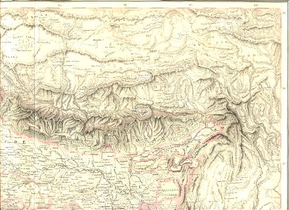
19th-century maps of india
latin-language maps
engraving on paper
koninklijke bibliotheek
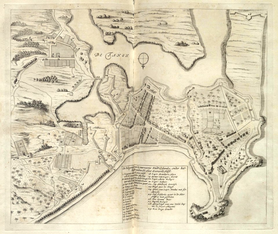
maps of the dutch east india company - indonesia
maps by jakob van der schley
jakob van der schley
eran laor cartographic collection
1665
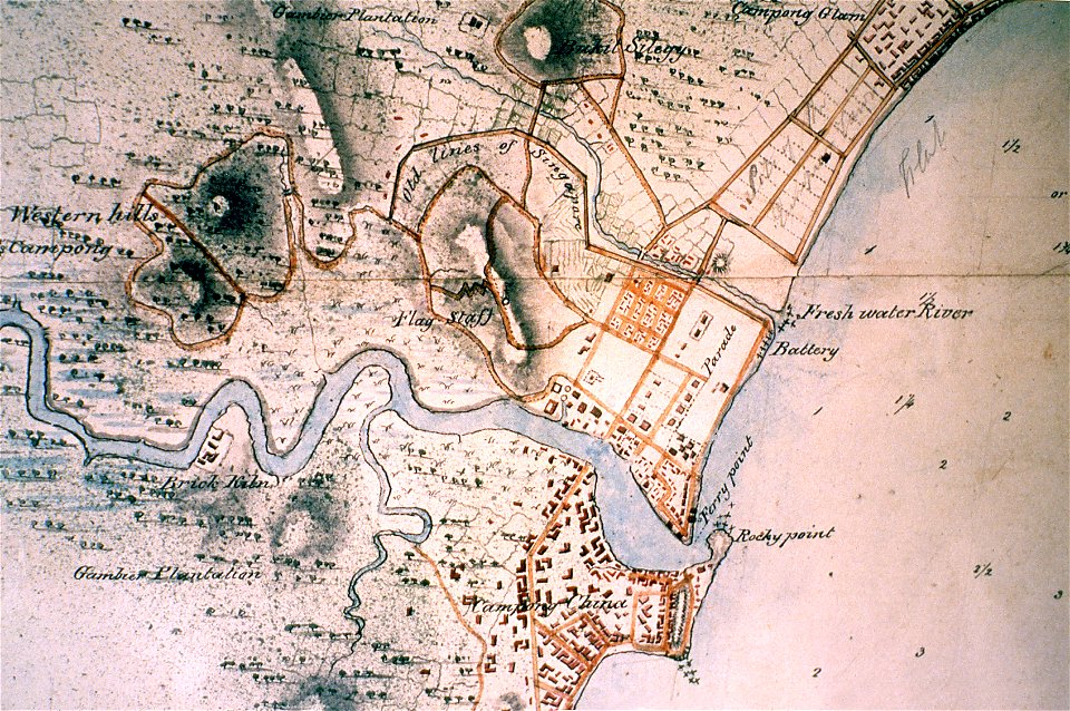
singapore river
singapore
gerard valck
indonesia
atlas van der hagen (volume 4)
maps with cartouches
media from atlas of mutual heritage on dutch east india company
1736
mataram sultanate
rembang regency
19th-century maps of india
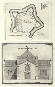
maps of the dutch east india company - sri lanka
1726
johannes janssonius waasbergen
1672
history of the french navy
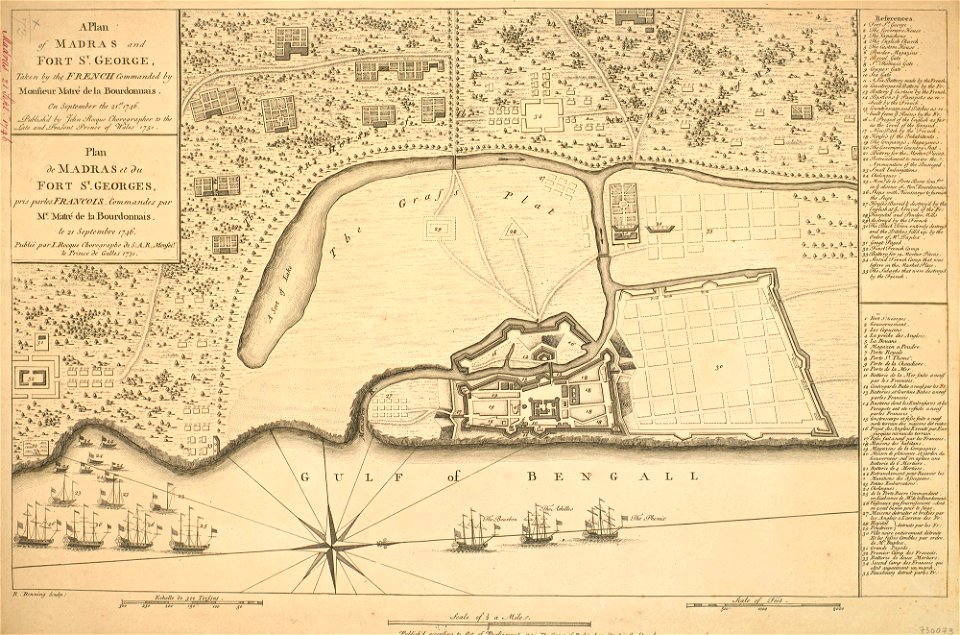
fort st. george
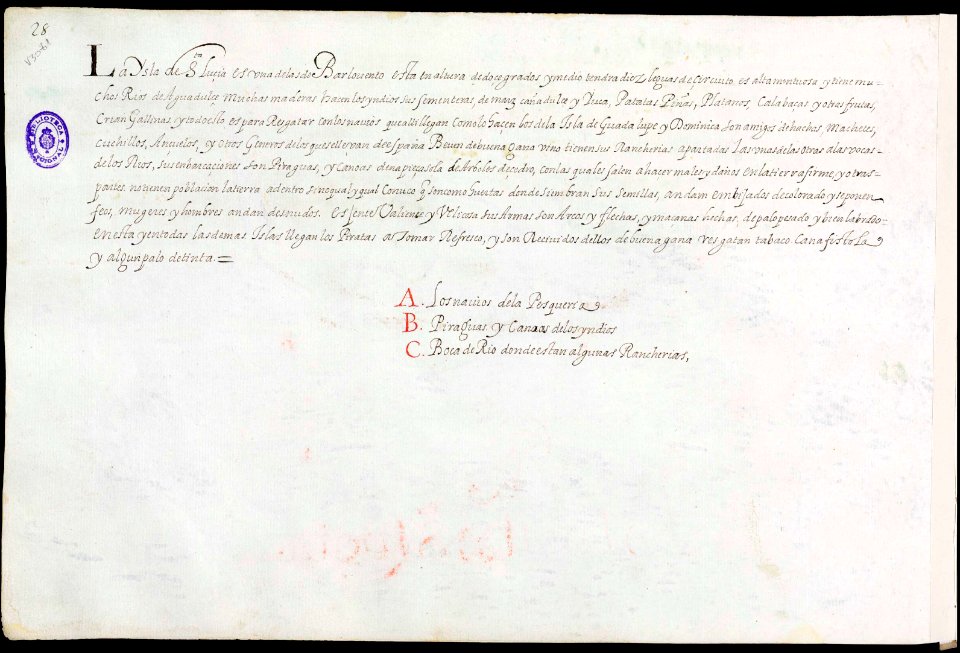
old maps of saint lucia
history of saint lucia
19th-century maps of india
johannes janssonius waasbergen
1672
19th-century maps of india
maps of the west-indische compagnie
1644
19th-century maps of india
19th-century maps of india
maps of the dutch east india company - indonesia
1646 drawings in indonesia
old maps of india
old maps of tibet
sailing ships of the netherlands
1665
old maps of goa
1596
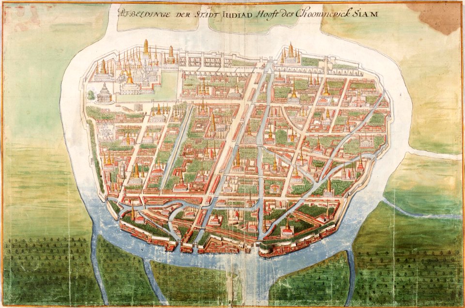
ayutthaya kingdom
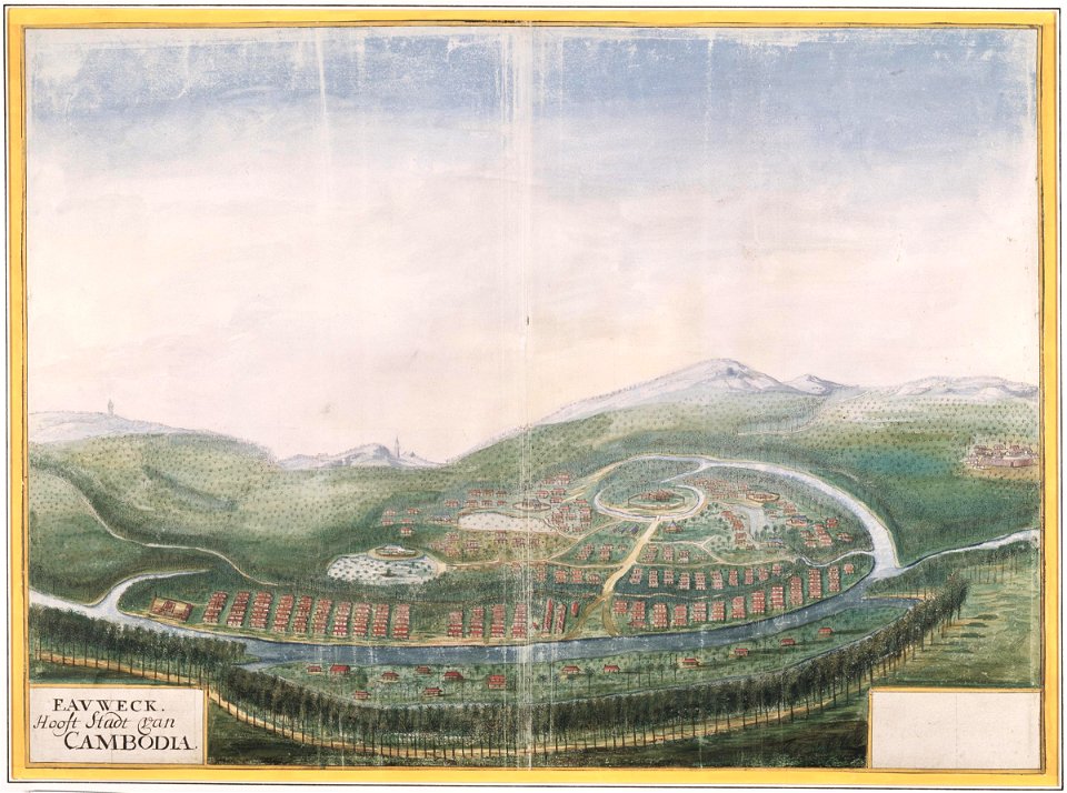
1665
history of cambodia
1665
itinerario (jan huygen van linschoten)
old maps of goa
maps made in the 17th century
nicolaes visscher ii
ottomar elliger (ii)
fort rotterdam
dutch east india company
fort san domingo
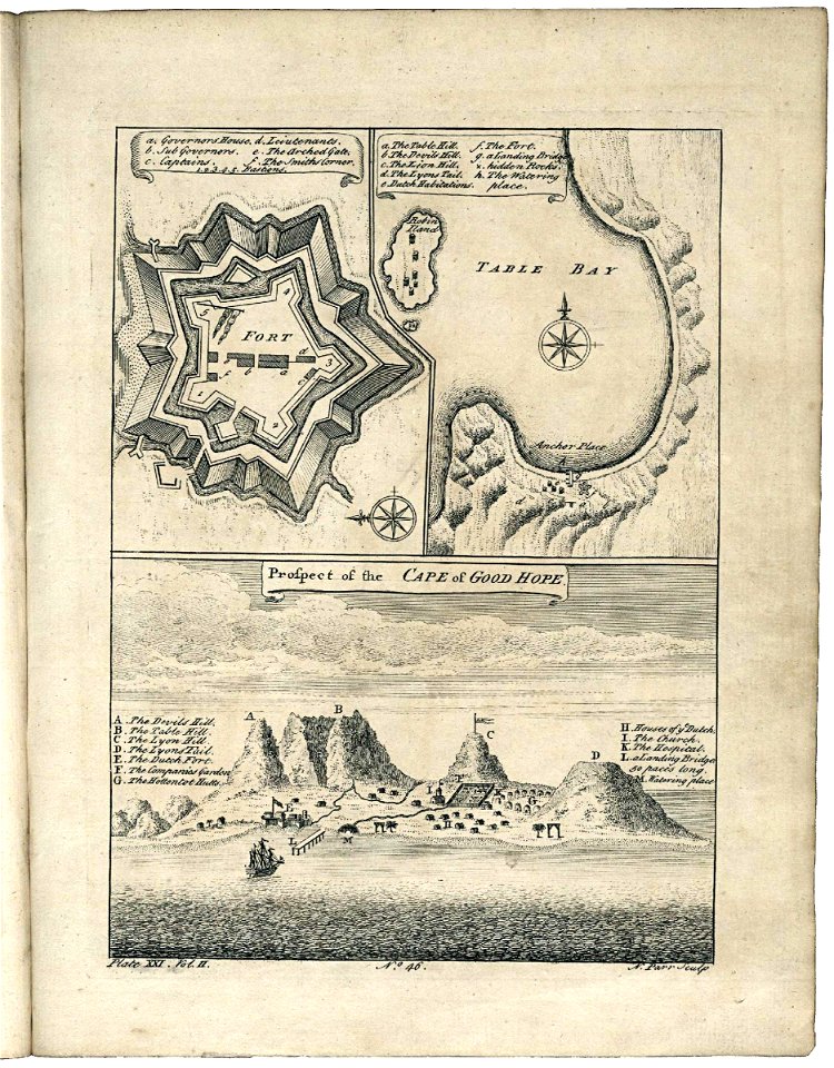
old maps of cape town
1745
portrait paintings of men by george romney
rococo
history of indonesia
mataram sultanate
british east india company
london
fra mauro map details
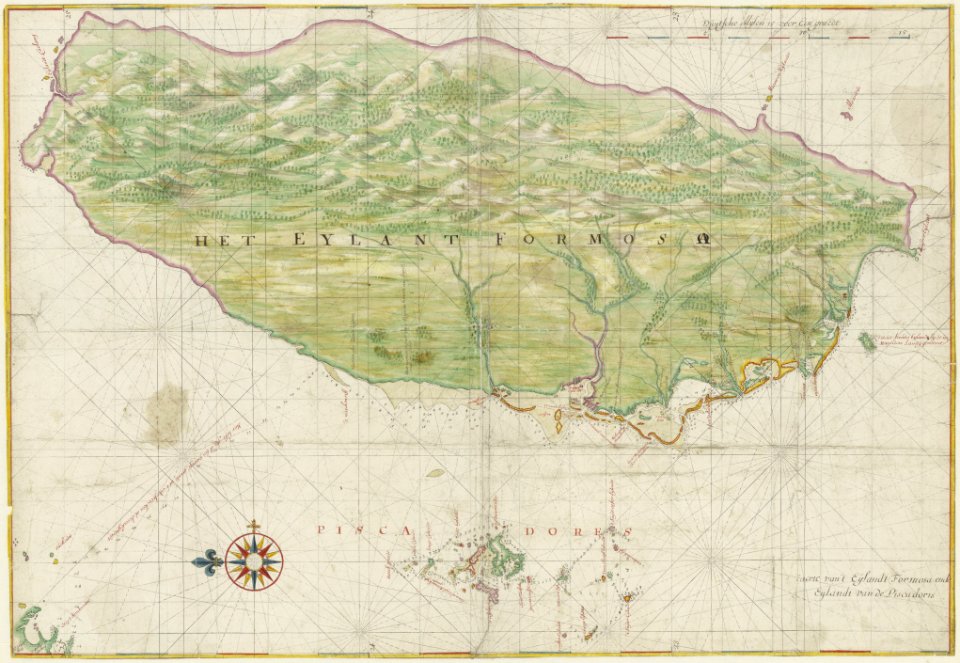
roc
1640s works in taiwan
1644 maps
maps of novaya zemlya
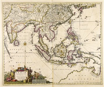
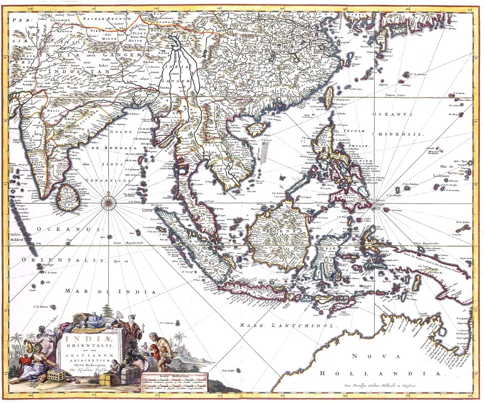
india orientalis
1670s works in taiwan
1670 maps
historical images of kollam
kollam port
sanson maps of asia
company land
maps of the dutch east india company - iran
old maps of the dutch east india company
maps by jakob van der schley
old maps of kollam
van langren map of southeast asia
1619 maps of asia
maps of the western ghats
maps of rivers of india
maps of kozhikode by braun & hogenberg
eran laor cartographic collection
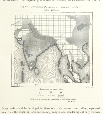
maps from the earth and its inhabitants, vol. viii
population density maps of india
maps by john cary
1806 maps of asia
maps of rivers of india
1886 maps of india
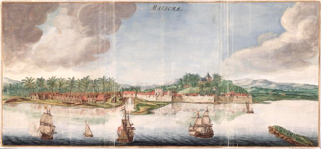
old maps of the dutch east india company - malaysia
maps of the dutch east india company - indonesia
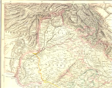
old maps of the punjab region
old maps of uttarakhand
fort zeelandia, taiwan in art
siege of fort zeelandia
maps by girolamo ruscelli
1570s maps of india
maps from the earth and its inhabitants, vol. viii
buddhist pilgrimage sites in india
maritime history of india
sailing ships of india
maps showing 19th-century history
19th-century maps of south asia
maps by willem and johannes blaeu
pantanal
maps by girolamo porro
leonardo cernoti
maps of goa by linschoten
portuguese india
1650s maps of taiwan
1654 maps
maps of the malay archipelago by mercator-hondius
hendrik van langren map of south asia
1590s maps of india
old maps of bouvet island
bouvet island
maps of the dutch east india company - bengal
maps of the dutch east india company - india
eran laor cartographic collection
hendrik hondius the younger
maps of antwerp by braun & hogenberg
maps of antwerp city walls
maps by johannes vingboons
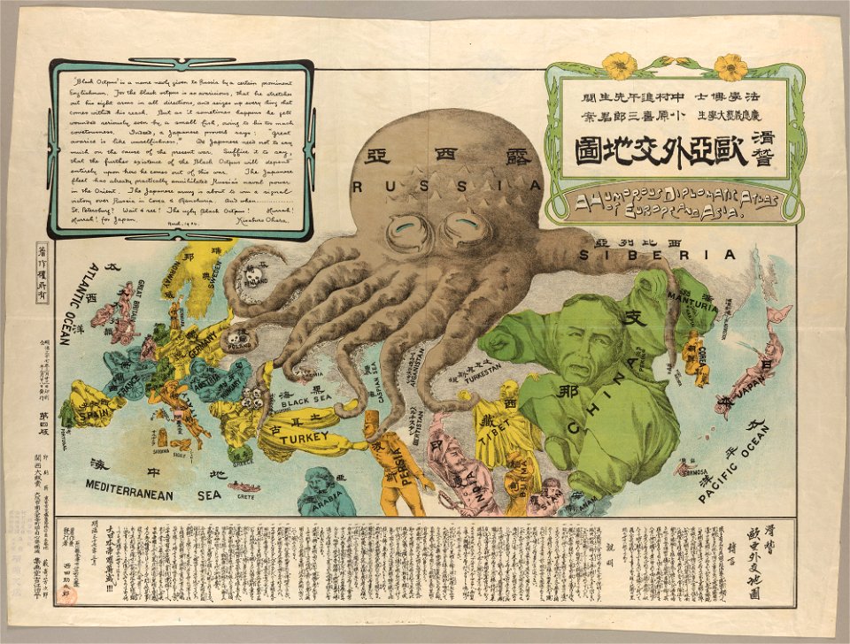
old maps of asia
maps of south asia by mercator-hondius
brazilian paintings in the museu antônio parreiras
antônio rafael pinto bandeira
english-language maps
maps by john cary
drawings in the museu antônio parreiras
graphite
old maps of bouvet island
bouvet island
eran laor cartographic collection
joan blaeu
drawings in the museu antônio parreiras
india ink and watercolor
navigantium atque itinerantium bibliotheca
18th-century maps of south asia
maps of the dutch east india company - indonesia
18th-century maps of sulawesi
maps of goa by linschoten
maps
media from atlas of mutual heritage on dutch east india company
portolan charts by willem and johannes blaeu
voyages and travels to india, ceylon, the red sea, abyssinia, and egypt, vol. 3
henry cooper (engraver)
maps of the ganges river
old maps of bengal
maps from the mechanical curator collection
1760
17th-century maps of south asia
maps by alexis-hubert jaillot
maps of the dutch east india company - china
1749 maps of asia
eran laor cartographic collection
william henry toms
19th-century maps of tibet
details of old maps
drawings in the museu antônio parreiras
paper and india ink
alphonsus lasor a varea
maps by jodocus hondius
17th-century maps of southeast asia
maps by jodocus hondius
maps of kodagu district
old maps of india
maps of the dutch east india company - india
dutch suratte
select views in india, drawn on the spot, in the years 1780, 1781, 1782, and 1783
british library asia, pacific and africa collections
portolan charts by willem and johannes blaeu
dutch east india company
maps of the dutch east india company - thailand
old maps of the dutch east india company
histoire universelle depuis le commencement du monde
maps of gulf of khambhat
histoire universelle depuis le commencement du monde
maps of gulf of khambhat
14th-century illuminated manuscripts from spain
jong (ship)
description de l'universe
1680s maps of india
eran laor cartographic collection
hendrik hondius the younger
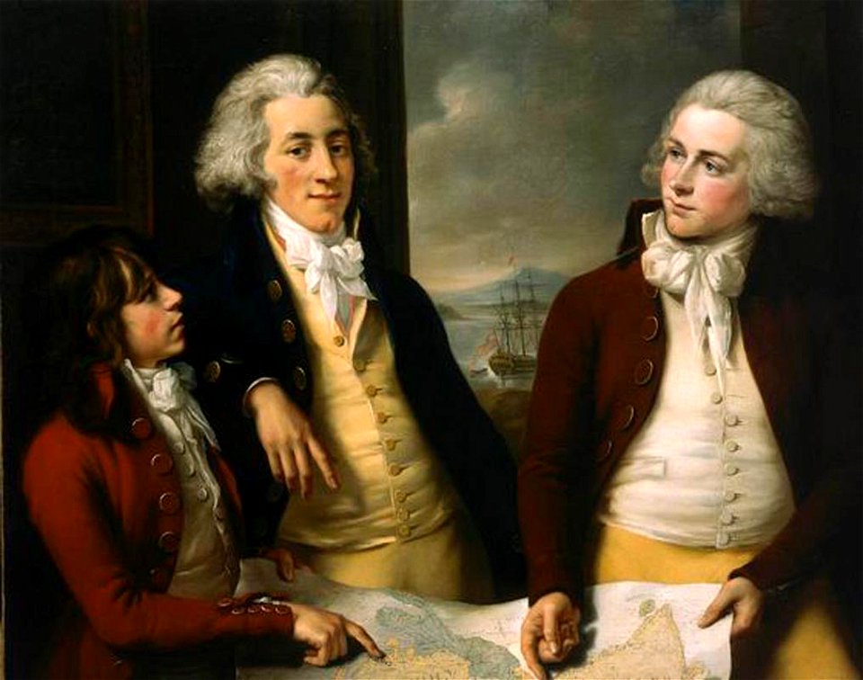
18th-century portrait paintings in the national maritime museum, london
john francis rigaud
ptolemy's 10th asian map
maps by girolamo porro
maps by willem and johannes blaeu
17th-century maps of india
fort victoria (moluccas)
johannes nessel
maps by pieter mortier
old maps of asia
maps by willem and johannes blaeu
laurens reael
maps of kozhikode by braun & hogenberg
maps of elmina by braun & hogenberg
401 - 500 of 717
Next page
/ 8